Our portfolio of completed projects demonstrates our expertise, dedication, and commitment to delivering exceptional results across various sectors. Below, we provide an in-depth look at each of our key project areas, showcasing the comprehensive services we offer and the advanced technologies we employ to ensure success.
01. TOPOGRAPHY SURVEY
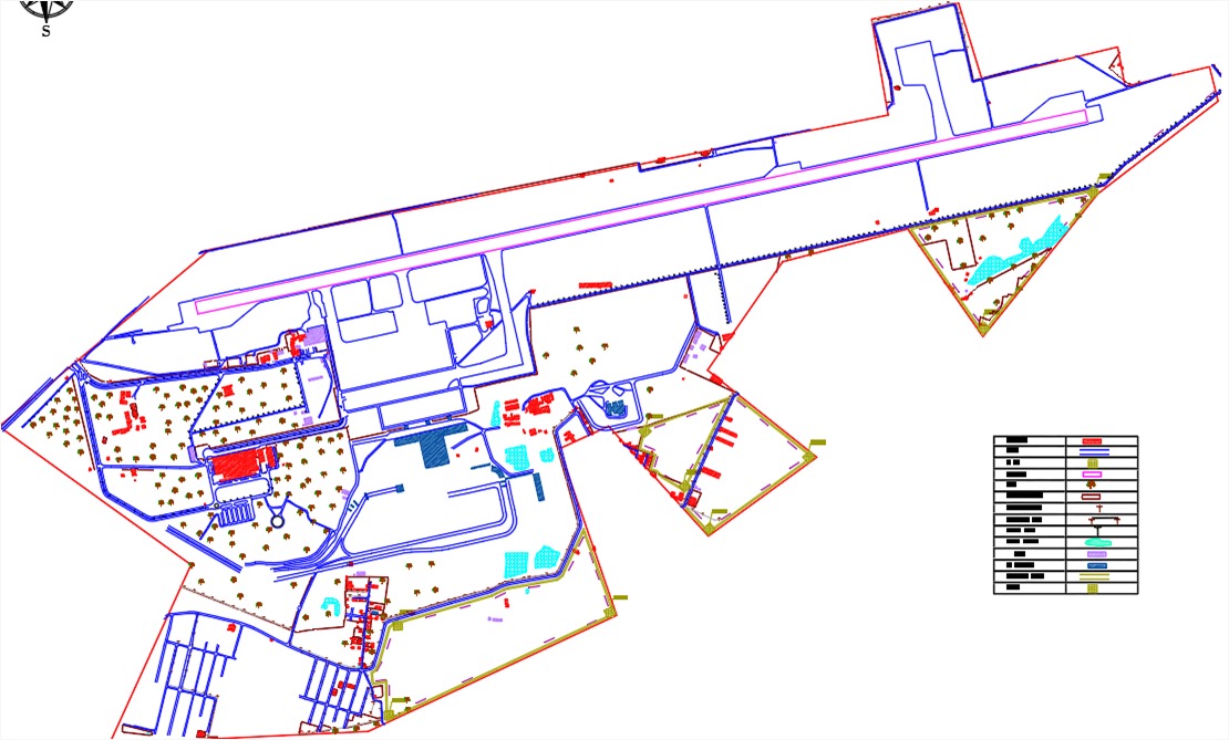
Accurate topographic surveys are the foundation of successful construction and development projects. Our topography survey services provide precise and detailed information about the land, enabling informed decision-making and effective planning.
Accurate topographic surveys are the foundation of successful construction and development projects. Our topography survey services provide precise and detailed information about the land, enabling informed decision-making and effective planning.
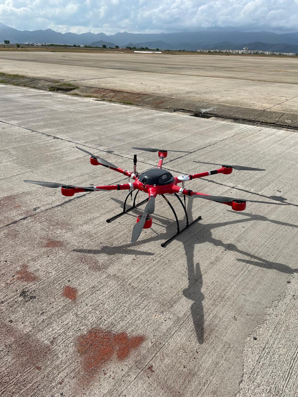
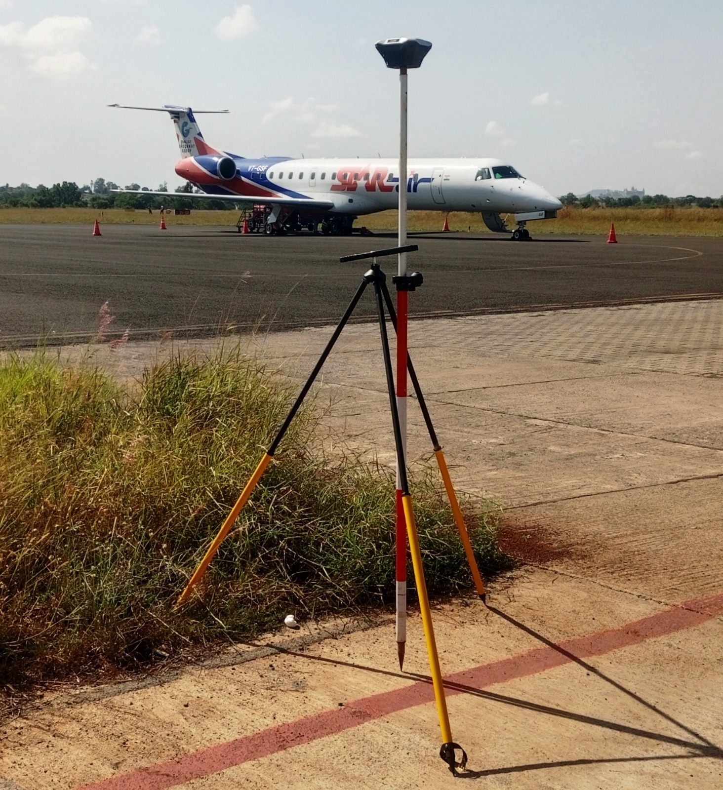
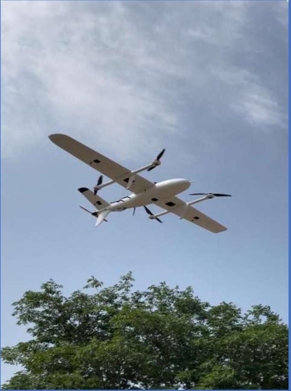
Topography Survey Using Drones & DGPS Equipment
Harnessing the power of modern technology, we utilize drones equipped with high-resolution cameras and Differential Global Positioning System (DGPS) equipment to conduct topographic surveys. This approach offers several advantages:
Efficiency: Drones can quickly cover large and difficult-to-access areas, reducing the time required for data collection.
Precision: DGPS ensures centimeter-level accuracy, providing reliable data for detailed mapping and analysis.
Safety: Remote surveying minimizes the need for personnel to navigate hazardous terrains, enhancing overall safety.
Our drone-assisted topography surveys capture comprehensive aerial imagery and detailed elevation data, which are essential for creating accurate topographic maps and 3D models.
We conducted topography surveys at several key airports.
02. DETAILED PROJECT REPORTS

Comprehensive Analysis and Documentation for Key Infrastructure Projects Our team excels in creating detailed project reports that serve as the blueprint for successful project execution. Each report is meticulously prepared, covering various facets such as design, feasibility, environmental impact, and financial viability. Our expertise spans multiple domains, including:
01. Airport Development
Our detailed project reports for airport development encompass every aspect from initial site selection to final construction. We conduct in-depth analyses of air traffic potential, environmental impact, and economic viability to ensure that the proposed airport meets all regulatory and operational standards.
02. Master Planning
We provide comprehensive master planning services that involve the strategic layout and design of large-scale developments. Our plans integrate land use, infrastructure, transportation, and environmental considerations to create sustainable and functional urban environments.
03. Pre-Feasibility and Feasibility Studies
Before any project begins, we conduct thorough pre-feasibility and feasibility studies. These studies assess the practicality of the proposed project, evaluating factors such as market demand, financial projections, and technical requirements. Our goal is to identify potential challenges early and provide actionable insights for successful project implementation.
04. Flood Risk/Drainage Analysis
In areas prone to flooding, our flood risk and drainage analysis services are critical. We evaluate the terrain, hydrology, and existing drainage systems to design effective flood mitigation strategies. Our analyses help in safeguarding infrastructure and communities from potential flood damage.
03. ARCHITECTURE
ALL TYPES OF ARCHITECTURAL DESIGNS AND PLANNING
Innovative Architectural Designs and Planning
Our architectural services cover a broad spectrum of design and planning needs. We cater to various types of structures, including residential, commercial, and industrial buildings. Our approach to architecture is centered on creativity, functionality, and sustainability. We work closely with clients to understand their vision, translating it into innovative designs that blend aesthetic appeal with practical utility. From conceptual design to detailed planning, our architectural solutions are tailored to meet the specific requirements of each project.
04. SURFACE GRADING
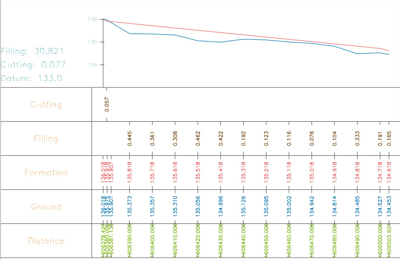
SURFACE GRADING & EARTHWORK CALCULATIONS
Precision Surface Grading & Earthwork Calculations
Surface grading is a crucial step in preparing land for construction and development. Our expertise in surface grading ensures that the land is accurately leveled and contoured according to the project’s specifications. We use advanced earthwork calculation techniques to determine the optimal amount of soil to be moved, minimizing costs and maximizing efficiency. Our precise surface grading services are fundamental to the stability and success of construction projects.
05. UTILITY DETECTION SURVEY
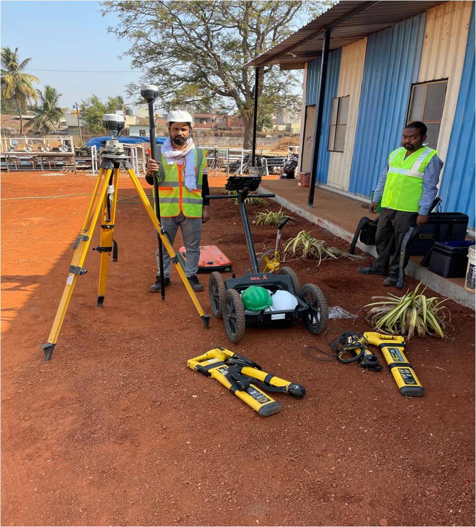

UNDERGROUND UTILITIES DETECTION USING UNDERGROUND PENETRATING RADARS & SENSORS
Our utility detection surveys utilize advanced underground penetrating radars and sensors to accurately locate and map underground utilities. This service is essential for avoiding costly damages during excavation and construction. By identifying the exact location of pipes, cables, and other underground infrastructures, we help ensure the safety and efficiency of your project.